Aerial Photogrammetry
|
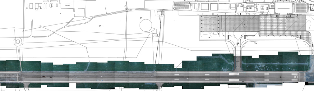
We perform aerial photogrammetric surveys (nadir and prospective) for technical purposes: planning, assessments and monitoring. The obtained images are orthorectified and geo-referenced to allow their use in GIS or CAD. Through the use of particular softwares, from stereoscopic images, we can obtain 3D models DEM’s and DTM’s. |
Ortofoto
3D Models
Through the use of dedicated softwares, from stereoscopic images, we can obtain 3D models of land or buildings to be included in CAD and GIS. The DTM or DSM thus obtained are used in geographic information systems (GIS) or CAD to have an accurate and detailed representation of the land design purposes.
THEMATIC MAPS
The digital orthophoto is an “integrated” tool for immediate investigation because it can provide essential data in many case studies (spatial planning, geological risk, seismic risk, etc.). Decisional elements are important for the census of illegal dumping, analysis of forest fire risk, etc. Our spatial data allows the construction of thematic maps with dedicated symbols such as building sites integrated with sections, dimensions, plant, logistics information, etc. We can also generate 2D and 3D sports facilities such as golf courses, ski slopes and roads, which can be uploaded on portable devices such as tablets and smartphones.
|


 English
 Italiano